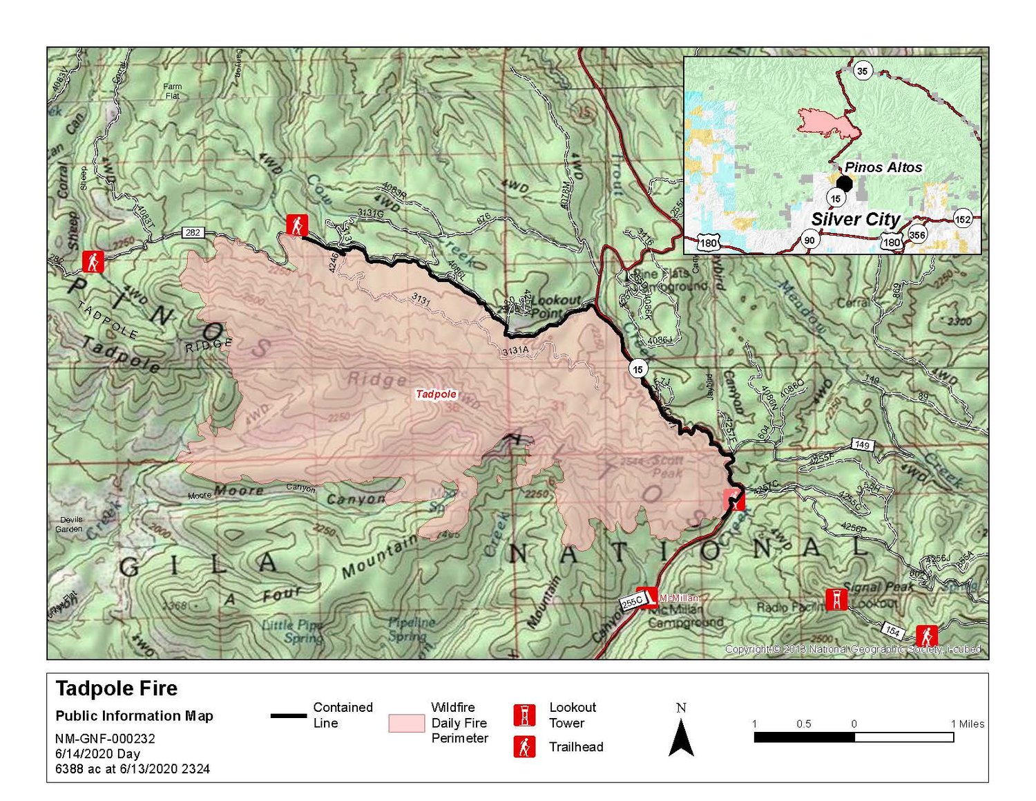
Location: 12 miles north of Silver City Start Date: June 6, 2020 Acres: 6,600
Cause: Lightning Total Personnel: 179 Containment: 25%
Vegetation: Timber with grass understory, brush, and chaparral
Resources: Two Type 1 20-person handcrews, two 20-person initial attack handcrews, one 8-person handcrew, one Type 3 heavy fire engine, four Type 6 light fire engines, one Type 3 medium helicopter, and one Type 1 heavy helicopter, and one dozer, Air tankers are available at the Gila Aerial Fire Base.
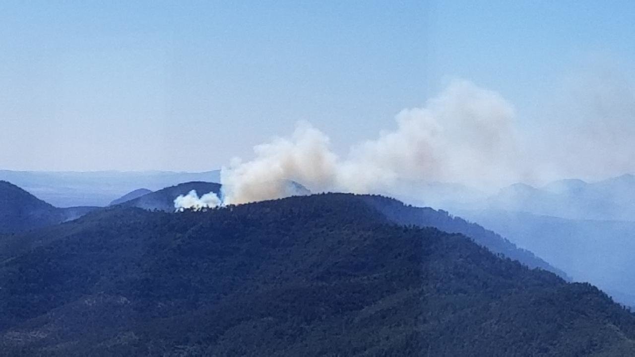
SUMMARY: The Tadpole Fire, now at 6,600 acres, was ignited by lightning and reported on June 6. The Tadpole Fire is located on the SW portion of Tadpole Ridge, on National Forest System lands, Gila National Forest. The fire is burning in timber with grass understory, brush and chaparral.
WEATHER: Weather forecast for today is very similar to yesterday with unseasonably moist air across the Gila National Forest. Clouds are expected to begin building up over the peaks by noon. Temperatures are steady with mild lows and seasonal highs. Somewhat lighter winds today, then breezy Tuesday, slight windy Wednesday. Tuesday is our last day with storm chances before warmer and drier conditions return, with breezy conditions for at least a full week.
FIRE BEHAVIOR: Fire behavior has diminished significantly diminished with recent increases in relatively humidity. With the drying trend later in the week, light smoke may be visible on occasion. No significant growth or progression of the fire has been noted during the last few operational periods.
SHIFT OF FOCUS: While fire crews continue to suppress and contain the Tadpole fire, assessments of the burned area are beginning. Local Burned Area Emergency Response team members are on the fire ground inspecting fire impacts to NM Hwy 15 and Sheep Canyon Corral Road #282. Watershed impacts will also be assessed. These assessments are the basis of post-fire actions taken to ensure public safety and to determine resources necessary to prevent further damage. As the assessment progresses, further information will be provided.
Air quality monitoring stations are being placed and will be providing smoke data and an air quality summary within the next 24 hours. Please visit https://fires.airfire.org/outlooks/SWNewMexico and https://www.cdc.gov/coronavirus/2019-ncov/php/smoke-faq.html for real time smoke monitoring data and a daily smoke summary.
Please see the New Mexico Department of Health site, https://nmtracking.org/fire for guidance on mitigating your smoke exposure. Smoke-sensitive individuals and people with respiratory problems are encouraged to take precautionary measures by staying inside during heavy smoke periods and avoiding outdoor activities.
SAFETY: The Gila National Forest is currently under a campfire ban, including the use of charcoal. Use of pressurized fuel devices are acceptable.
A temporary flight restriction is in place over the fire area. Wildfires are a No Drone Zone. For more information visit Know Before You Fly, http://knowbeforeyoufly.org .